Clustering through self-organisation: How thunderstorm cells 'communicate' with each other
August 21, 2020
A large part of the rainfall in the tropics is the result of several thunderstorm cells merging to form a large thunderstorm complex – known in technical terms as a mesoscale convective system. A new study by researchers from the Leibniz Centre for Tropical Marine Research (ZMT), Jacobs University and the University of Copenhagen now provides further insight into the processes involved in the formation of large thunderstorm accumulations. The results of the model simulation have recently been published in the journal 'npj Climate and Atmospheric Science'.
A mesoscale convective systems (MCS) is a complex of thunderstorms of at least 100 kilometres in diameter that can last up to ten hours and can be a precursor of tropical storms. Such systems are often accompanied by extreme rainfall, strong winds and increased lightning. How exactly thunderstorm cells form such accumulations or clusters, however, has not yet been clarified in detail.
A study by physicist Jan O. Haerter, head of the 'Complexity and Climate' group at ZMT and Professor of Complex Systems at Jacobs University, now suggests that part of the 'clustering' occurs through self-organisation.
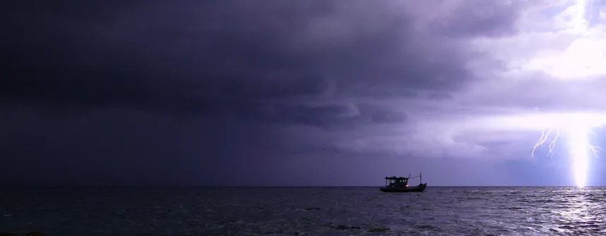
, Thunderclouds in Palau (Source: Sonia Bejarano, Leibniz-Zentrum für Marine Tropenforschung [ZMT])“The thunderstorm cells 'communicate' with each other to a certain extent, which leads to interactions among individual cells,” says Professor Haerter, summarising the results of the study. “An important role is played by so-called cold pools, which are formed beneath the thunderclouds and spread into the environment.”
Thunderclouds form clusters when surface temperatures vary strongly
Using model simulations on large parallel computer systems, the research team has been able to show that clusters of thunderstorm cells form over land, in particular when the underlying surface temperature greatly varies between day and night. Temperature differences of seven degrees Celsius between daytime highs and night-time lows are enough, which can occur in many tropical regions.
According to the scientists' calculations, over the ocean no clustering occurs as long as the temperatures of the water surface are relatively constant. “Our simulations still show that when temperatures fluctuate clustering also occurs above the oceans thus leading to the formation of MCSs," reports Haerter.
Cold pools trigger further thunderstorms in a chain reaction
The researchers substantiate their results with simplified, conceptual models to explain the interactions between the clouds. The authors’ interpretations of their results are based on the occurrence of the so-called 'cold pools'. These arise when rainfall below thunderclouds evaporates in the air before reaching the earth's surface. The evaporation cools down the air and makes it sink. When these cold air masses hit the surface, they are deflected laterally and can expand for kilometres into the environment.
"If cold pools spread out in a radius below a thunderstorm cell, sporadic collisions take place between them, causing further thunderclouds to form,” says Haerter about the model. "At points where these cold pools enclose air masses, the trapped air is forced upwards leading to new thunderstorm cells to form there, which in turn create cold pools in an evolving chain reaction.”
In their study the researchers show how continental cloud formation creates large combined cold pools that are capable of triggering further thunderstorms in a chain reaction over land – a process referred to as “continental self-organisation”.
Effects of mesoscale convective systems (MCSs)
When MCSs occur, larger regions are affected by heavy rainfall and winds than during individual thunderstorms. Heavy, long-lasting precipitation, in turn, can lead to flash floods, which can cause rivers to burst their banks. Nutrients in the soil are washed out of the ground during heavy rainfall and transported by rivers into the seas and oceans with sediment also reaching coastal regions from the hinterland.
Mesoscale convective systems are often precursors of tropical cyclones, which have devastating effects on coastal regions and pose a major threat to the local populations and ecosystems such as coral reefs or mangroves.
In coastal regions, especially in the tropics, two effects may coincide, says Haerter: “On the one hand, we have the continental self-organisation of thunderstorm clusters that form over land, discharge there or migrate towards the coast. On the other hand, when temperatures fluctuate above water, there can also be maritime self-organisation, potentially leading to MCSs and maybe even hurricanes over the sea.”
Publication:
Haerter, J.O., Meyer, B., Nissen, S.B. (2020). Diurnal self-aggregation. npj Climate and Atmospheric Science 3(1), pp. 2397-3722. DOI: 10.1038/s41612-020-00132-z
Contact:
Professor Jan O. Haerter
Head of the working group ‚Complexity and Climate‘ at Leibniz Centre for Tropical Marine Research (ZMT) and Professor for Complex Systems at Jacobs University Bremen
Email: jan.haerter [at] leibniz-zmt.de
Tel: +49 (0) 151 – 71524696 or +45 607 48 750
